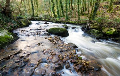
The Luxulyan Valley, just north of St Austell is both a beautiful, natural woodland and a fascinating heritage site. The steep-sided valley stretches around 2 miles along the banks of the River Par from Luxulyan to the St Blazey.
The Cornish name for the valley is Glynn Gwernan, which means 'alder tree valley'. This refers to the ancient broad-leaved woodland that is home to a range of wildlife including over 40 species of fern and various other flora and fauna of conservation importance. Luxulyan Valley is also a regionally important geological and geomorphological site (RIGS).
Whilst there is little doubt as to the valley's natural beauty what makes the place special are the decaying remains from when this was an important part of the mining industry. Even in the earliest days of Cornwall's mining history Luxulyan was important as a source of wood for charcoal which was used to smelt the locally mined tin and copper. Most of the industrial remains that are scattered throughout the valley are the work of Joseph Treffry, the owner of the Fowey Consols mines, a highly productive copper mine. Much of the development was concerned with transporting the ores from the mines to the sea at Par.
Throughout the valley you can find the remains of the horse-drawn mineral tramroads where carts loaded with stone, china clay, copper ore, lime, coal, and mining materials once ran. The rails are gone but you can still see the lines of granite blocks that supported the rails.
The other transport network through the woods is the system of leats used to carry water. Some of these such as the Fowey Consols Leat ran for several miles. In the early 19th century water was an essential commodity for industry, providing a power source by driving water wheels which would in turn power various machines.
Perhaps the most interesting of all the industrial remains in Luxulyan Valley are those of the Carmears Wheel Pit. The impressive granite structure was built to hold a mighty water wheel which was used to generate the power to haul ore-laden trucks up the adjacent slope known as the Carmears Incline. In later years the wheel powered a china clay grinding mill and you can still see some of the rusty old machinery here.
Of all of Treffry's legacies it is the magnificent ten-arch Treffry viaduct that he will most likely be remembered for. Spanning the valley, this 100ft high structure had two functions; firstly it carried the mine trucks over the valley and secondly it carried the water used to power the water wheel at Carmears. Today you can walk across the viaduct or just marvel at this 19th century engineering feat from the valley floor.
One way to see the Luxulyan Valley is by train as the Newquay to Par branch line runs alongside the River Par for much of the valley's length. However, without doubt the best way to see the valley is on foot. There are two popular walking routes from Luxulyan village through the valley; one at 2.5 miles, the other at just under 4 miles. Both these routes take in the Treffry Viaduct with the longer walk taking in more of the historic mining remains.


